Peaks Climbed: "Lost World Butte", "Canyon Point Butte" & "The Sphinx"
Peak Heights: 5,464' / 5,500' / 5,350'
Route: Pearly Gates / Windy Crack / N Ridge
Difficulty: 5.5 C0 / 5.7 / 5.7
Location: Moab Area, Utah
Trailhead: Tombstone Butte
Mileage & Gain: 5 mi & 1,200 ft RT
Date Climbed: October 19, 2018
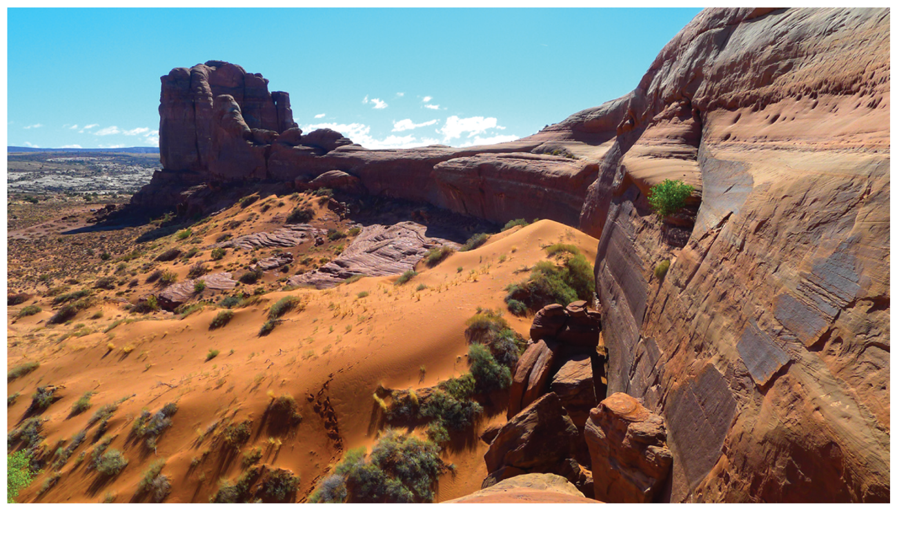
Lost World Butte and friends sit in a nondescript area about 20 miles northwest of Moab. Canyon Point Butte and The Sphinx are not officially named but they are part of a grouping labeled "The Needles" on the USGS map. Lost World Butte is just a nickname as well, given to the long, narrow butte to the northwest. The area is easily accessed via good dirt roads near the northern entrance to Canyonlands National Park.
This casual trio proved to be a good objective on a chilly fall day. We got a late start around noon and it was still only 40 degrees. The route descriptions for Canyon Point Butte and The Sphinx on Mountain Project were abysmal and led to a lot of confusion and wasted time.
For The Sphinx and Canyon Point Butte park at the base of Tombstone Butte and hike to the east side of the saddle between the two. Gain the saddle via a very short pitch with two bolts. Then head south for The Sphinx or north for Canyon Point Butte.
The route up The Sphinx follows the narrow north ridge for two easy but sandy pitches that are easily linked with just a few draws. The climbing is forgettable, but the closeup view of Tombstone Butte makes it worthwhile. From the top we did a double rope rappel off the east side, but in hindsight we should have just rapped the route to more efficiently return to the saddle and bag Canyon Point Butte.
The route up Canyon Point Butte utilizes an obvious crack on the broad south ridge. The 5.7 pitch is sandy but straightforward and well protected. There is a rap anchor at the top of the crack, and the summit is an easy scramble from there. To descend, return to the saddle via a single rope rappel and then do another short rap back from whence you came.
For Lost World Butte, continue driving past Tombstone Butte for about a mile and a half and park on slickrock near the road's end. The Pearly Gates route is obvious. It follows an easy but poorly protected ramp system for two pitches and then aids up a short bolt ladder to the summit mesa. The highpoint is a bit of a hike from here. To descend, rappel from the anchor a bit south of the topout point with two ropes. We had a hell of a time pulling the ropes and spent forever hauling with all we had as darkness settled around us. This has happened to others as well. You have been warned!